Restaurants
Bedrock Depot
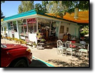
BEDROCK DEPOT
Sandwich and Ice Cream Shop
214 Brontosaurus Blvd
Dinosaur, CO 81610
Coffee and Ice Cream MenuSandwich Menu
Hours of Operation
Sunday 1 :00 pm - 4:00 pm
Monday 11 :30 pm - 3:00 pm
Tuesday 11:30 pm - 3:00 pm
Wednesday & Thursday CLOSED
Friday 11 :30 pm - 4:30 pm
Saturday 11:30 pm - 4:30 pm
Highway Bar and Grill

HIGHWAY BAR AND GRILL
Beer and Burgers
211 East Highway 40
Dinosaur, CO 81610
Hours of Operation
Closed Monday & Tuesday
Wednesday 11:30 pm - 8:00 pm
Thursday 11:30 pm - 8:00 pm
Friday 11:30 pm - 8:00 pm
Saturday 11:30 pm - 8:00 pm
Sunday 11:00 am - 5:00 pm
- Facebook Feed